Historical Weather API Update - Historical Satellite based Precipitation
New Historical Weather API Feature(s): - Historical Weather Data API: Multi-sensor satellite based precipitation
Historical Weather Data API Update: Multi-sensor satellite based precipitation
Our Historical Weather API now serves multi-sensor satellite based precipitation derived from the NASA Global Precipitation Measurement project.
This amazing product allows for retrieval of precipitation observations in areas where very few ground based observations exist (Africa, Asia, South America, etc).
Why does this matter?
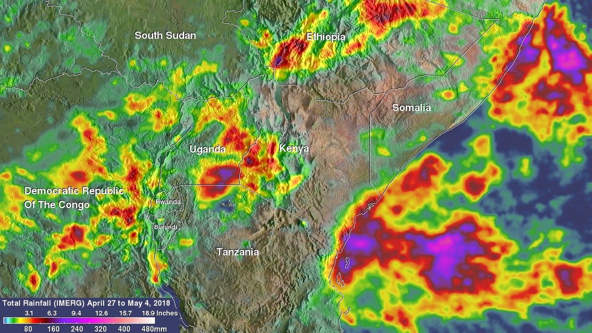
Accurate precipitation is critical for many industries. For example, an Agronomist may be interested in the impact a recent rainstorm on agriculture output in central Africa. Reliance on stations (gauge based) precipitation would be inadequate, because there are less than 500 total reporting stations in central Africa!
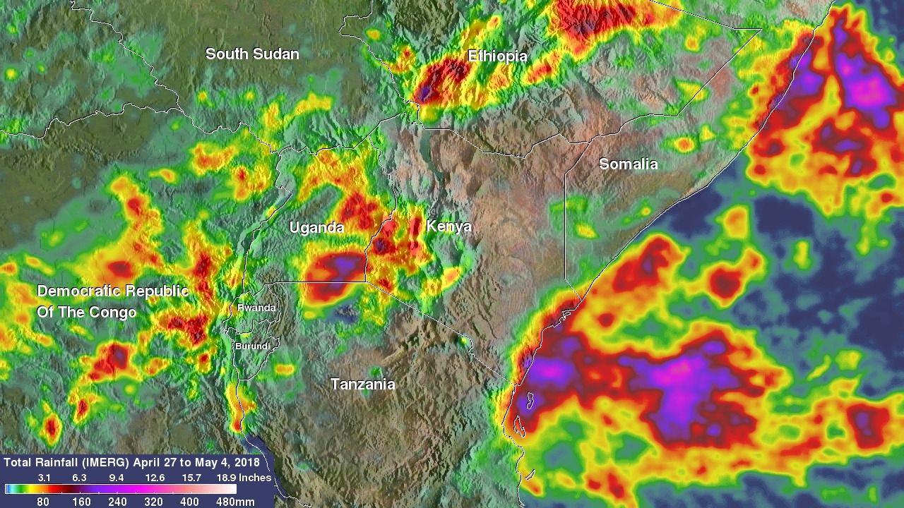
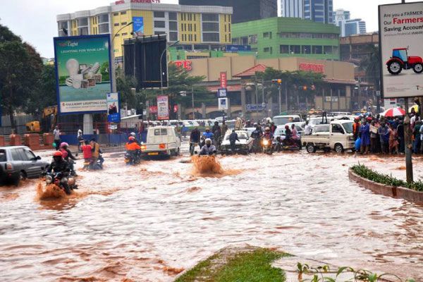
In the example above, over 50-150 mm of rainfall fell over areas of south Uganda, and western Kenya between April 27 and May 4, 2018. This rainfall fell over a drought stricken area, and resulted in displacement of over 200,000 people, and over 100 deaths.
Well, did nearby weather stations pick up this rainfall? Let's check!
| Location | Station precipitation (mm) | Satellite precipitation (mm) |
|---|---|---|
| Kampala, Uganda | 0 mm | 90 mm |
| Bungoma, Kenya | 0 mm | 160 mm |
| Sigatu Island (Lake Victoria) | 0 mm | 110 mm |
How about other historical weather data providers?
| Provider | Precipitation | ||
|---|---|---|---|
| Kampala, UG | Bungoma, KE | Sigatu Island, UG | |
| Competitor A | 0 mm | 0 mm | 0 mm |
| Competitor B | 0 mm | 0 mm | 0 mm |
| Competitor C | 5.4 mm | 132 mm | 73 mm |
| Weatherbit | 90 mm | 160 mm | 110 mm |
According to most other providers, it was a nice week in Kampala. Not a drop of rain fell from the sky. While our satellite backed observations paint a different picture:
Conclusion
Accurate precipitation is critical for many industries. Station based precipitation alone is simply not adequate to analyze rainfall. Especially over areas with little to no station coverage, or a history of poor data controls. We hope you will enjoy this update. We have many more coming soon!
The Weatherbit API Team